


Smithton, MO
Advertisement
Smithton Map
Smithton is a city in Pettis County, Missouri, United States. The population was 510 at the 2000 census.
Smithton is located at 38°40?50?N 93°5?33?W / 38.68056°N 93.0925°W / 38.68056; -93.0925 (38.680652, -93.092456). According to the United States Census Bureau, the city has a total area of 0.3 square miles (0.8 km²) or 192 acres.
As of the year 2000, the population density was 1/4 people per square mile (679.0/km²). There were 212 housing units at an average density of 728.0 per square mile (282.3/km²). The racial makeup of the city was 97.45% White, 0.78% Native American, 0.20% Asian, 0.39% from other races, and 1.18% from two or more races. Hispanic or Latino of any race were 0.59% of the population.
Nearby cities include Syracuse, Hughesville, Cole Camp, Pilot Grove, Tipton.
Places in Smithton
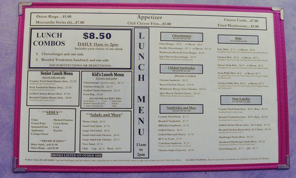
Dine and drink
Eat and drink your way through town.


Can't-miss activities
Culture, natural beauty, and plain old fun.
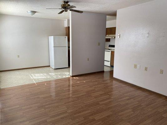


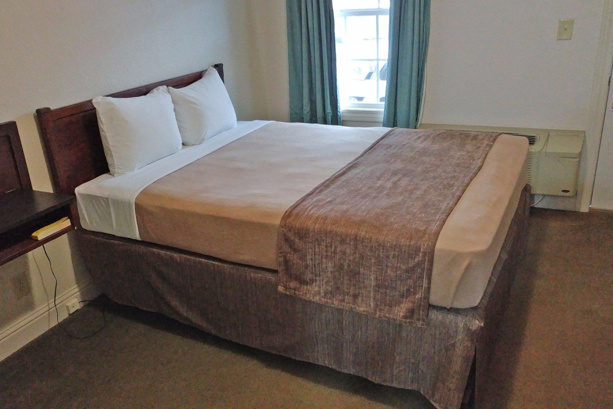
Places to stay
Hang your (vacation) hat in a place that’s just your style.


Advertisement