Scranton, PA
Advertisement
Scranton, PA Map
Scranton is a US city in Lackawanna County in the state of Pennsylvania. Located at the longitude and latitude of -75.662412, 41.408969 and situated at an elevation of 227 meters. In the 2020 United States Census, Scranton, PA had a population of 76,328 people. Scranton is in the Eastern Standard Time timezone at Coordinated Universal Time (UTC) -5. Find directions to Scranton, PA, browse local businesses, landmarks, get current traffic estimates, road conditions, and more.
Scranton, Pennsylvania, is famously known as the setting for the popular television show "The Office," which has become a cultural touchstone for fans worldwide. Beyond its television fame, Scranton boasts a rich history rooted in the coal industry, earning it the nickname "The Electric City" due to its role in early electric streetcar development. The city's historical significance is well-preserved and showcased at the Lackawanna Coal Mine Tour and the Steamtown National Historic Site, where visitors can explore the legacy of steam railroading. The Electric City Trolley Museum further highlights Scranton's contribution to early transportation innovation.
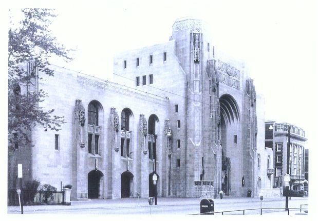
For those interested in arts and culture, the Everhart Museum offers an eclectic collection of natural history, science, and art exhibits. The Scranton Cultural Center at the Masonic Temple hosts a variety of performances and events in its beautifully designed historic building. Outdoor enthusiasts can enjoy the scenic beauty of Nay Aug Park, which features walking trails, a gorge, and waterfalls. Scranton's vibrant downtown area offers a mix of dining, entertainment, and shopping options, with local favorites like the historic Radisson Lackawanna Station Hotel providing a glimpse into the city's past with a touch of modern luxury.
Nearby cities include: Dunmore, PA, Taylor, PA, Throop, PA, Moosic, PA, Old Forge, PA, Olyphant, PA, Dickson City, PA, Roaring Brook, PA, Duryea, PA, Blakely, PA.
Places in Scranton
Dine and drink
Eat and drink your way through town.
Can't-miss activities
Culture, natural beauty, and plain old fun.
Places to stay
Hang your (vacation) hat in a place that’s just your style.
Advertisement


