


Amistad, TX
Advertisement
Amistad Acres, TX Map
Amistad Acres is a US city in Val Verde County in the state of Texas. Located at the longitude and latitude of -101.167325, 29.515220 and situated at an elevation of 348 meters. In the 2020 United States Census, Amistad Acres, TX had a population of 53 people. Amistad Acres is in the Central Standard Time timezone at Coordinated Universal Time (UTC) -6. Find directions to Amistad Acres, TX, browse local businesses, landmarks, get current traffic estimates, road conditions, and more.
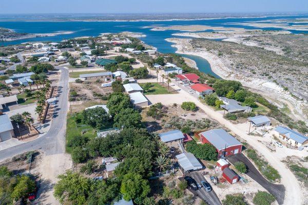
Amistad Acres, located in Texas, is a hidden gem primarily known for its proximity to the Amistad National Recreation Area. This expansive outdoor haven is a major draw for visitors seeking water-based recreation, including boating, fishing, and swimming, thanks to the clear waters of the Amistad Reservoir. The area is also a hotspot for birdwatching and hiking, with numerous trails that offer picturesque views of the surrounding landscape. The city itself exudes a tranquil charm, making it a perfect retreat for those looking to escape the hustle and bustle of urban life.
Historically, the region around Amistad Acres is rich with archaeological significance. The nearby Seminole Canyon State Park and Historic Site showcases ancient rock art and petroglyphs that offer a glimpse into the lives of the area's earliest inhabitants. This connection to the past is a point of pride for the community and adds a layer of cultural depth to the natural beauty of the area. Visitors to Amistad Acres often find themselves captivated by both the serene environment and the historical narratives that the region has to offer.
Nearby cities include: Cienegas Terrace, TX, Del Rio, TX, Laughlin Air Force Base, TX.
Places in Amistad


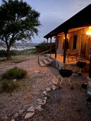
Places to stay
Hang your (vacation) hat in a place that’s just your style.
Advertisement